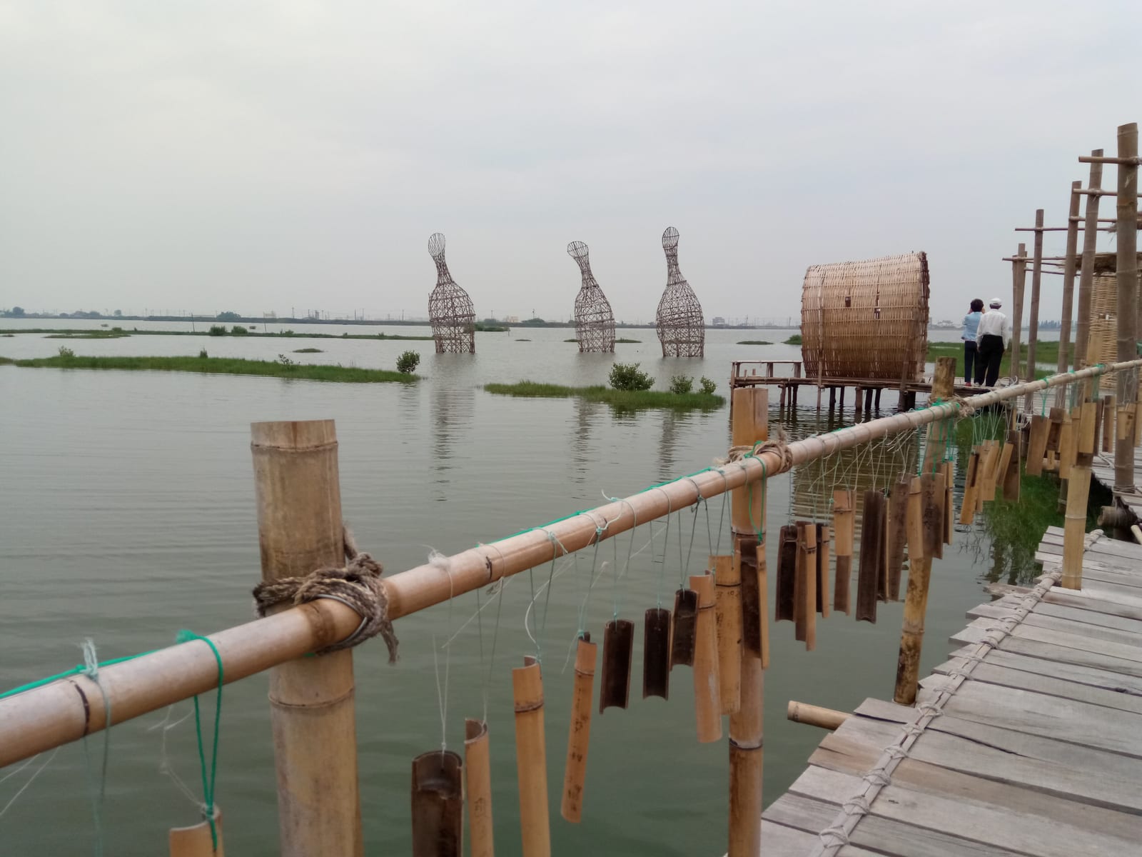
Chenglong Wetlands are a wetland ecosystem in Kouhu Township, Yunlin County, formed by land subsidence; Typhoon Wayne in 1986 breached the dikes and flooded farmland with seawater, and the waterlogged land gradually transformed into wetlands covering about 171 hectares, now listed as a nationally important wetland. Since 2009 the Kuan Shu Educational Foundation has led community-building work here, and the annual Chenglong Wetlands International Environmental Art Festival draws artists from around the world.
Chenglong Wetlands cover about 171 hectares (per Kouhu Township Office and the Southwest Coast National Scenic Area). In 1986, Typhoon Wayne breached more than 100 meters of dike and flooded the farmland with seawater within 15 minutes; the land remained waterlogged and gradually turned into wetlands. It was formally preserved as wetland under an 'ecological fallow' scheme in 2005, and since 2009 the Kuan Shu Educational Foundation has led community-building efforts and the International Environmental Art Festival, held annually for more than 9 editions to date.
Highlights of Chenglong Wetlands
The wetlands contain an interlocking mix of open water, reed beds, and tidal mudflats that support a diverse range of habitats. Autumn and winter — roughly October through March of the following year — mark the peak season for migratory and wintering birds, when herons, sandpipers, plovers, and pheasant-tailed jacanas can be observed. An environmental education trail runs along the water's edge, flat throughout, suitable for walking or cycling. The Chenglong Wetland Conservation Station (Forestry and Nature Conservation Agency, Ministry of Agriculture) provides ecological interpretation services; guided tours can be booked before you go.
The Chenglong Wetlands International Environmental Art Festival is held annually; artists use the wetland environment as their medium to create large-scale installations scattered along the trail, forming an outdoor exhibition that merges with the natural landscape. The festival period — usually spring, with exact months varying year to year — draws the largest visitor numbers. Outside festival season the trail remains open, and wildlife observation is quieter and more relaxed.
How to make the most of your visit
Practical information
Getting there and hours
- The wetland trail is open year-round with no fencing restrictions. For Conservation Station service hours, check the official information from the Forestry and Nature Conservation Agency. Guided interpretation activities may be offered on holidays.
- Public transport to Kouhu Township is very infrequent; driving is recommended. The car park is at the wetland entrance in Chenglong Village. Parking spaces are limited on weekends and during the art festival — arrive early.
- Summer afternoons along the coast are prone to rain showers; spring can be foggy; autumn and winter are windy. Check the weather before you go.
Nearby connections
- Kouhu Township's coast also has Jinhu Reservoir and Kezailiao Fishing Harbor; these can be combined for a coastal Yunlin half-day trip.
- About thirty kilometers north is Mailiao Gonggfan Temple; heading south enters the coastal area of Budai Township in Chiayi County, allowing the itinerary to extend to the Chiayi coast.
Sources: Forestry and Nature Conservation Agency (Ministry of Agriculture), Wetlands Taiwan.
Frequently Asked Questions
How large are Chenglong Wetlands?
About 171 hectares, now listed as a nationally important wetland.
How did Chenglong Wetlands form?
Typhoon Wayne in 1986 breached the dikes and flooded farmland with seawater; the waterlogged land gradually turned into wetlands.
When did the international art festival begin?
The Kuan Shu Educational Foundation moved in in 2009 and has held the festival annually since.
Sources
- 成龍濕地 — 口湖鄉公所官方資料,濕地面積171公頃
- 前進地層下陷重災區,雲林第一棟成龍濕地高腳屋落成 — 農傳媒,濕地形成背景與社區營造沿革