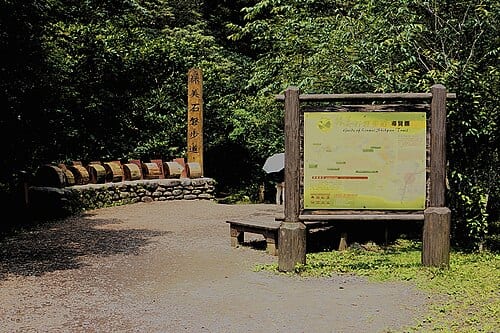
Linmei Shiban Trail is a loop trail along Linmei Stream in Linmei Village, Jiaoxi Township, Yilan, officially measured at 1.7 km by the Forest and Nature Conservation Agency — one of the most frequently recommended hiking routes near Jiaoxi. The trail takes its name from the granite slab landforms encountered along the way; water flows between the rocks with a clear, audible sound, the forest cover is well preserved, and ferns and mosses cling to the rock faces. Sections of the trail have previously been closed due to unstable slopes, so check the managing agency's latest notice for the current open range before visiting.
According to the Forest and Nature Conservation Agency, Linmei Shiban Trail is officially 1.7 km long, forms a loop, and sits at an elevation of roughly 200–300 m, rated Grade 2 (suitable for general visitors). Due to slope instability in the trail's later section, only the 0–0.9 km segment has at times been open; check the agency's latest notice for the current open range.
Highlights of Linmei Shiban Trail
The trail follows the Linmei Stream valley throughout, with relatively gentle terrain; most sections are dirt paths, with some wooden boardwalks or stone-paved sections. The granite slabs in the streambed, when water levels are high after rain, produce a pleasant burbling that is striking both visually and aurally. The forest canopy is dominated by broadleaf trees with high closure, providing good shade in summer and making it a good retreat from the heat of the lowlands.
Ecological highlights along the trail include numerous fern species, mosses, and freshwater shrimp and crabs in the stream. Bird activity is most frequent in the early morning, with a variety of birdcalls audible. The difficulty is low overall, suitable for adults of average fitness and older children; the full loop takes about 1 to 1.5 hours. Small food and drink stalls can be found near the trailhead.
How to make the most of your visit
Practical information
Getting there and travel time
- Drive from Jiaoxi town center along Jiaoxi Road, then turn onto Linmei Road to the trailhead — about 15 minutes. There is parking space near the trailhead.
- There is no fixed direct public transport; you can take a taxi from Jiaoxi Station to the trailhead (fare approximately NT$100–150) and call a taxi back after the walk.
Nearby connections
- Jiaoxi Hot Spring Park is about 15 minutes by car after the trail; the morning trail plus afternoon foot soak is a common itinerary pairing.
- Some orchard farms in the nearby Paoding area offer fruit-picking experiences, depending on the season.
Sources: Yilan County Jiaoxi Township Office; Forestry Bureau trail information; Wikipedia entry on 'Linmei Shiban Trail.'
Frequently Asked Questions
How long is Linmei Shiban Trail?
According to the Forest and Nature Conservation Agency, the official length is 1.7 km, forming a loop route.
How difficult is the trail?
It is rated Grade 2 (suitable for general visitors), at an elevation of roughly 200–300 m with a gentle gradient, suitable for family hikes.
Is the whole trail currently open?
The trail's later section has previously been partially closed due to unstable slopes; the open range changes with agency notices, so check the latest information before setting out.
Where does the trail's name come from?
The trail is named for the granite slab landforms found along the way, where the stream flows between the rocks — the trail's most distinctive feature.
Sources
- 林美石磐步道 - 台灣山林悠遊網 — 官方全長1.7公里、海拔、難度、開放狀態