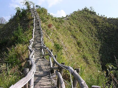
Dakeng Scenic Area is a hiking destination in Beitun District, Taichung, known for twelve trails of varying difficulty. The trails span roughly seventeen kilometres in total, at elevations between 112 and 859 metres, and on clear days offer panoramic views over the Taichung Basin — making it the most popular weekend escape for local residents.
Dakeng Scenic Area covers more than 3,300 hectares, with elevations ranging from 112 to 859 metres — the summit of Toukezan at 859 metres was once the highest point within the former Taichung City limits. Of the twelve main trails, Trails 1 to 5 were planned by National Chung Hsing University's landscape design team on commission from the Taichung city government and completed in 1981, while Trails 6 to 8 were built in 1990. Six streams, including Dakeng Creek and Zhuoshuikeng Creek, run through the scenic area.
Highlights of Dakeng Scenic Area
Dakeng lies in the Beitun District of Taichung, in the hilly terrain at the northeastern edge of the Taichung Basin. Vegetation is predominantly secondary broadleaf forest, with dense, well-formed woodland and quiet stream valleys. The scenic area has twelve numbered hiking trails ranked by difficulty, ranging from a few hundred metres to several kilometres in length. Each trail is equipped with distance markers and rest facilities, making it easy for hikers to track conditions along the way.
Several viewing platforms are placed along the trails, offering views of the Taichung Basin and distant mountain ranges on clear days. Streams run through the area, supporting a rich ecosystem where native Taiwanese birds and plants can be observed. Early morning is the most comfortable time to hike, when the mountain air is cool; trails can be slippery after rain, so non-slip hiking shoes are recommended.
How to Make the Most of Your Visit
Practical Information
Getting There & Hours
- Dakeng Scenic Area is open year-round with no admission fee. Trail entrances are spread out; check the Taichung City Tourism Bureau's official website before you go for the latest trail conditions.
- Driving is the most convenient option. There are car parks in the Dakeng area of Beitun District; arriving early on weekends helps avoid parking difficulties.
- By public transport, take a Taichung city bus to Dakeng Station and walk to the individual trail entrances. Check the Taichung BRT or city bus website for current routes and schedules.
Nearby Connections
- Combine with other sights in Beitun District, or head to nearby restaurants in the Dakeng dining area for a meal featuring local mountain cuisine.
- The drive from central Taichung takes about 20–30 minutes, making it easy to pair with a city itinerary — hike in the morning, explore downtown in the afternoon.
Sources: Taichung City Tourism Bureau; Wikipedia entry on Dakeng Scenic Area.
Frequently Asked Questions
How many hiking trails does Dakeng Scenic Area have?
Dakeng Scenic Area has twelve main numbered trails ranging in difficulty, with a combined length of roughly seventeen kilometres.
Is Dakeng Scenic Area suitable for beginners?
Yes — Trails 1 and 2 are gentle and well maintained, making them a good starting point for beginners and families, while Trails 4 and 5 offer steeper ridgeline routes for more experienced hikers.
Is there an admission fee for Dakeng Scenic Area?
No, Dakeng Scenic Area is open year-round free of charge, with trail entrances spread across the hills of Beitun District.
What is the highest point in Dakeng Scenic Area?
The highest point is the summit of Toukezan at 859 metres, once the highest peak within the former Taichung City boundaries.
Sources
- 大坑風景區 - 維基百科 — 面積、海拔、步道數量與闢建年代
- 旅遊資訊-大坑登山步道 - 臺中市風景區管理所 — 官方步道資訊